Hurricane Imelda is expected to strengthen and lash Bermuda on Wednesday, according to the Miami-based National Hurricane Center.
Imelda is the ninth named storm of the 2025 Atlantic hurricane season. It formed on Sunday in the western Atlantic and strengthened into a hurricane early Tuesday.
Hurricane Imelda forecast maps
As of 5 a.m. ET Wednesday, Imelda’s center was located 455 miles west-southwest of Bermuda, with maximum sustained winds of 90 mph, making it a a Category 1 storm. It was moving east-northeast at 20 mph.
“Imelda is expected to be stronger, near Category 2 strength, when it moves close to Bermuda late today,” the hurricane center said.
CBS News
“I cannot overstate the seriousness of this threat,” said Michael Weeks, Bermuda’s minister of national security, as the storm approached. “This is not, I must stress, a passing squall.”
Anywhere from 2 to 4 inches of rain is expected across Bermuda from Wednesday into Thursday, which could lead to flash flooding, the NHC said. A dangerous storm surge is also expected to produce coastal flooding in Bermuda “in areas of onshore winds,” the hurricane center said, adding that the surge “will be accompanied by large and damaging waves.”
Swells generated by Imelda and Hurricane Humberto, farther out in the Atlantic, were also affecting the Bahamas and spreading to much of the U.S. East Coast. “These swells are likely to cause life-threatening surf and rip current conditions,” forecasters said.
NOAA / National Hurricane Center 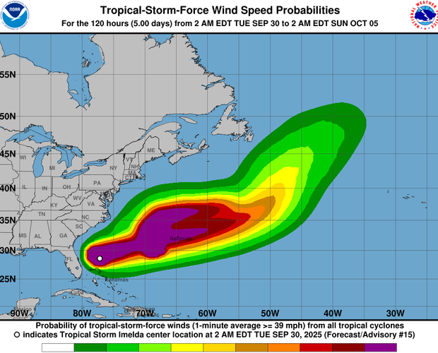
Warnings and watches for Imelda
A hurricane warning is in effect for Bermuda, meaning hurricane conditions are expected to occur there.
An earlier tropical storm warning for the northwestern Bahamas was canceled Monday night.
Imelda follows Hurricane Humberto
Imelda comes on the heels of Hurricane Humberto, which rapidly intensified to a major hurricane over the Atlantic on Saturday but is not expected to reach land. Humberto reached as high as a Category 5 on Saturday before beginning to weaken. Tuesday morning, it was a Category 2 with sustained winds of about 100 mph.
NOAA / National Hurricane Center 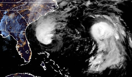
Forecasters said last week there was a small possibility the two systems could interact, creating what is known as a Fujiwhara effect, a rare phenomenon in which two different storms merge and become entangled around a newly formed, common center. However, they said it wasn’t considered a likely outcome in this case.
CBS News 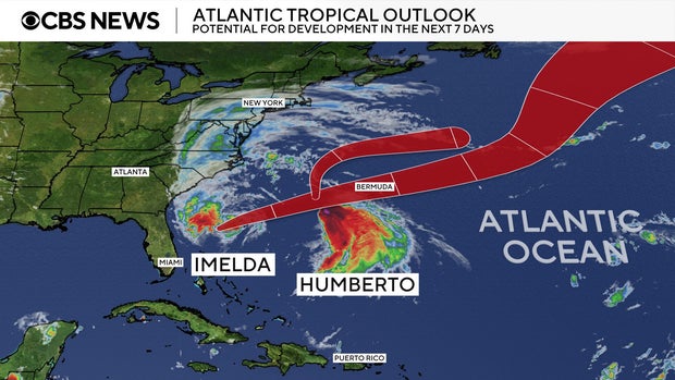
contributed to this report.